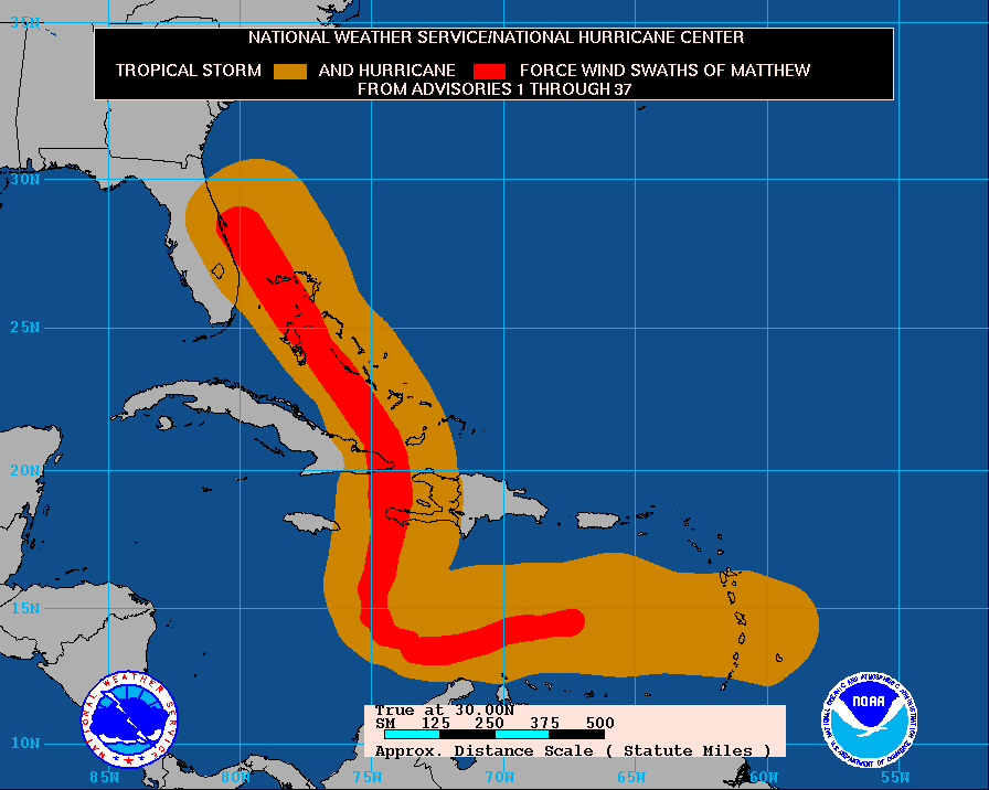
Currently, I am writing this article from my evacuation location in Naples, Florida. The talk of the Southeast states is, of course, Hurricane Matthew. This hurricane started off of the coast of Africa as a small low-pressure system and gradually gained strength as it moved westward across the Atlantic Ocean. Its general path was in a southwestward motion, headed toward the northern crest of Venezuela , and then rapidly made a 90-degree turn to the North, headed toward the Caribbean islands of Jamaica, Haiti, and Cuba (As seen below).
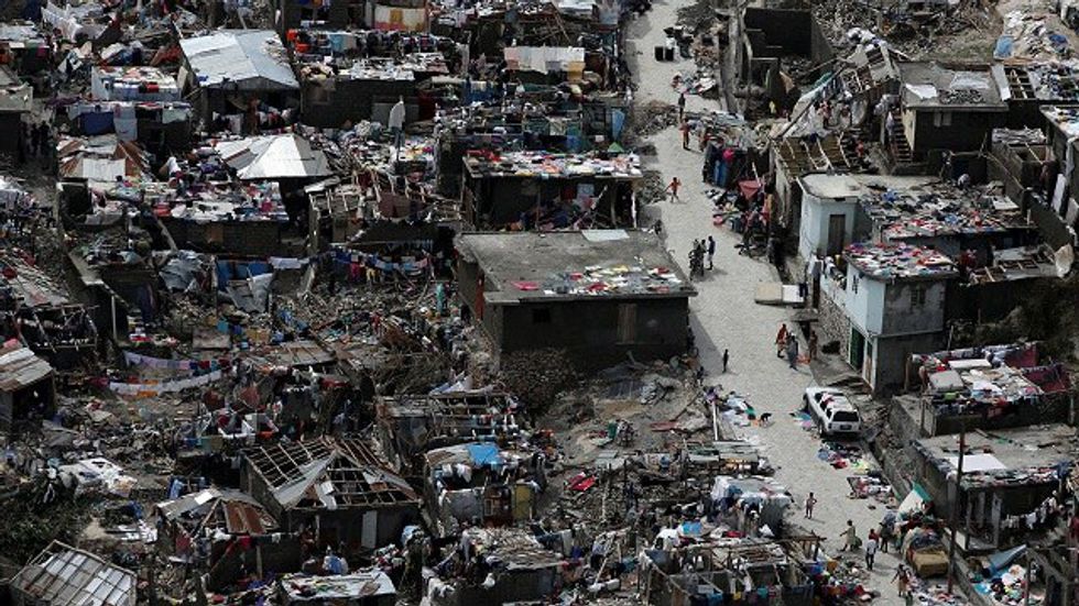
This hurricane has been the strongest in 10 years, and because of that, most people living in these areas were not prepared or did not know how to adequately prepare for the worst. The people of these islands were warned, but time was not on their side. Most people could not evacuate, and that has resulted in a high death count. Many homes have been destroyed throughout the duration of this storm.
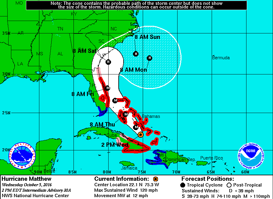
Not too long later, the storm made a turn in a north-northwest direction towards the Bahamas. The storm began to weaken a bit from a Category 4 to a Category 3, but the pressure in the center of the storm began to lower itself further, creating a higher potential for strengthening again.
The hurricane track through the Bahamas was the tipping point of the start of evacuations all throughout Florida. As this point, I made the decision to evacuate myself and head to the west coast of Florida. The projected path was headed straight for Daytona Beach and was supposed to make landfall as a Category 4 storm. Lucky for us residents of Daytona Beach, the hurricane made a last-minute shift to the east and missed making landfall by 30 miles. Even though 30 miles seems like a lot, Daytona and many other cities along the eastern coast of Florida were majorly damaged and loss of power is widespread.
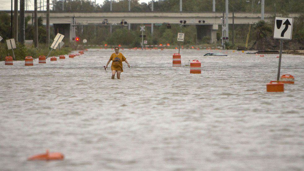
As the storm trekked up the eastern coast, it began to weaken from a Category 3 down to a Category 2 as it reached Jacksonville and eventually on Saturday it was downgraded to a Category 1. It reached Georgia and unloaded winds and rain there, and some areas experienced flooding, and when it made its way to South Carolina and North Carolina, just rain began to fall and minor winds which created perfect conditions for flooding all along the coast and even to the extent of 80 miles inland.
Here are some of the images taken after the storm passed:
Damage in Haiti
More Damage in Haiti
Damage in Baracoa, Cuba
Damage in Daytona Beach, Florida
Hurricane Matthew Floods Georgia Roads
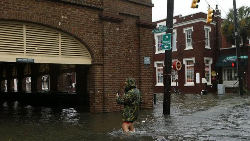
Major Flooding in Charleston, South Carolina Streets
As you can tell by the pictures above, the damage is worse in some areas and light in others. Over 5,000 flights were cancelled to various areas in Florida, Georgia, South Carolina, and North Carolina due to this storm and even theme parks throughout Orlando shut down completely (which never happens). Bridges and roads were closed and interstates were opened to only westbound traffic for evacuations. Over 400 lives have been lost now in Haiti.
This is not a storm that should have been taken lightly by anyone, because you never know the real damage it can do until it happens. Thank you to all of the government personnel, first responders, and businesses who helped expedite the evacuation process, and by doing so saved so many more lives.


