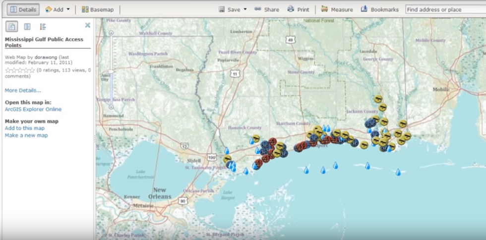
There is no doubt that the growth of geospatial technology is dramatic and prominent in the global economy today. The field is growing to a degree that hasn't been seen since the implementation of the web creating more computer coders almost exponentially. Many are wondering what is the vast field of study and why is so integral to the way our society functions today? The implementation of this new technology had it's course set many years ago once companies like Esri and QGIS began making hardware programs that create shapes and symbols that are based off projects from the earth. Further implementation of statistics, facts, and figures, has also led to the growth of geospatial technology. This technology has only effected the world for about the past 50 years or so. The latest version of geospatial technology was only developed about 20 years ago. The real question everyone should be asking is how much will GIS (Geographic Information Systems) have an impact on the future world economy? Will corporations and small businesses alike use geospatial technology for all the data and statistics that they store? I believe they will. Here's why.
Geospatial technology was first introduced into the world in the 1970's when the implementation of applications such as apple and microsoft were invented by Steve Jobs, Steve Wozniak, and Bill Gates. These fundamental programs were used to create GIS applications that could be used for practical map making. This was a new and much more advanced type of cartography than previously in world history however. This is because this type of map making could take data and plug it into a computer programming formula to create algorithms that would show up as a geographical point, line, or polygon and help solve a problem spatially. This type of spatial analysis and data uses spatial grids and coordinate systems in order to run algorithms and solve problems using existing statistics. This type of statistical data is usually retrieved through the use of an excel spreadsheet otherwise known as an attribute table on programs like ArcMap, and QGIS. All this data is saved and stored in either a shapefil, KML file, or a geodatabase. There are addition types of geodatabases for certain types of data as well.
The first implementer and creator of Gespatial technology was Jack Dangermond. He wanted to found a company that would lead the future of geographical technology for many years to come. He started off by using basic C++ Coding language to create a new program that would run shapes, lines, and points, Today this type of visualized data is known as vector and raster data. Esri stands for the Environmental Systems Research Institute and was founded in 1968. The main mission was to produce research products that would go towards helping the environment through technological aide tools. This new technology was supposed to help scientists make breakthroughs in making transportation more fuel efficient. Scientists mainly decided to focus on fuel efficient cars and other motor vehicles first. They needed to design engines in vehicles that would be more fuel efficient. This means that the car would have to use up much less fuel in the same amount of time than previous cars. Dangermond also founded the company on land survey analysis but quickly turned into the development of GIS software development. Today Esri is the largest GIS software developer anywhere in the world. Jack's company went on to be one of the most visual geography/coding corporations to ever exist. His visionary idea of creating a company that would create software for geographical points and locations was enough to make Jack Dangermond a multi-billionaire.
Is the impressiveness of both Jack Dangermond of Esri enough to get one to think about how important this technology is in our daily lives? If not than maybe the thought that all of the U.S. military's strategic bombing targets are all done through geospatial technology such as remote sensing and radar sensing technologies. Geospatial technology is one of the reasons we are kept save here at home. Geospatial technology is the main reason why all of your packages get delivered to the right address at the right time(for the most part). These GPS or the global positioning system that all of us have on our phones and electronic devices is why we know where we need to go when we are looking for a new place or trying to find a specific location. Businesses who need to devise a plan as to where a new store location should be placed at is done through geospatial intelligence and coordinate systems.
This is why GIS and Geospatial Technology should be looked upon as sacred. This technology will help save lives and make life much more productive for millions of people. Everyone needs to take into consideration how important GIS is in out daily lives. In fact, one could not live at all without geospatial technology either directly or indirectly effecting there life. This technology is too essential to put on the back burner and know I hope you know why.


