The other day, J.K. Rowling released an official map of the locations of all the Wizarding Schools in the world. I have always had a passion for history, maps, random information, and generally being a nerd, so here is my list of the 16 maps that you didn't know you needed to see.
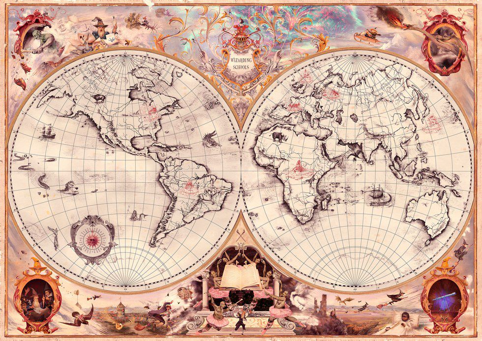
1) Wizarding Schools
So I'm actually going to begin this article with the map that started this idea: the map of the locations of the Wizarding Schools in the world. Of course, there is Hogwarts in Scotland, Beauxbatons in France, and Durmstrang in Russia (Well, most people say Sweden or Norway, but the map clearly places it in the Finno-Russian region). In addition, there are four new schools: Ilvermorny in the Eastern United States, Castelobruxo in the Amazon, Uagadou in the heartland of Africa, and Mahoutokoro in Japan. It's the map that every Harry Potter nerd needs.
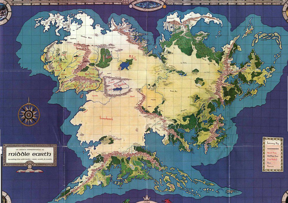
2) Hypothetical Completion of Middle Earth
Continuing with the literary theme, I have always wondered what Middle Earth would look like had Tolkien illustrated a complete map of the continent. This map I found comes from the 1984 board game Middle Earth Role Playing. Although not officially created by J.R.R. himself, it was approved by Tolkien Enterprises, the company that manages all his copyright materials.
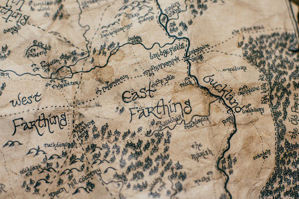
3) Hand-drawn map of Hobbiton
Now for a little detail in the world of Tolkien. This map is a close-up look at Hobbiton, but what I found most special about it is the fact that someone actually hand drew it. It's incredible how talented some people can be.
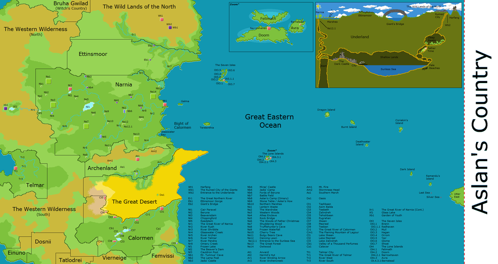
4) Lands of Narnia and Surrounding Kingdoms
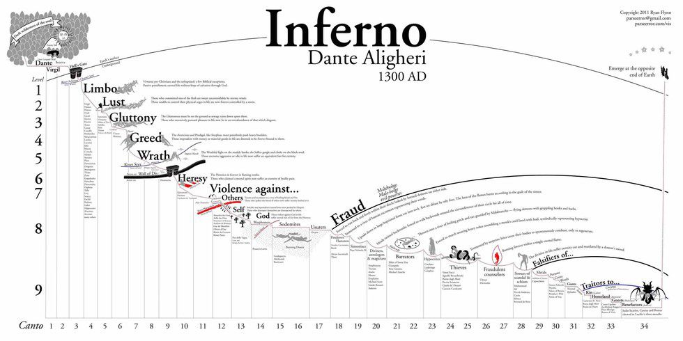
5) Dante's Inferno
This is something straight out of your high school English Literature course, and quite frankly would have been helpful then to pass the class. It gives a very detailed portrayal of each circle, and the corresponding punishments, as well as some famous people found in the circles.
6) Tamriel from the Elder Scrolls
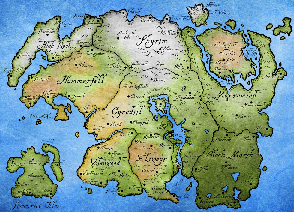
The final fantasy realm map, Tamriel is the map from the Elder Scrolls series of video games. This map helps gives a greater picture of how all the regions fit together as a whole, from Skyrim in the north, Morrowing in the east, and the Summerset Isles in the southwest.
7) Portuguese Cold War Satire
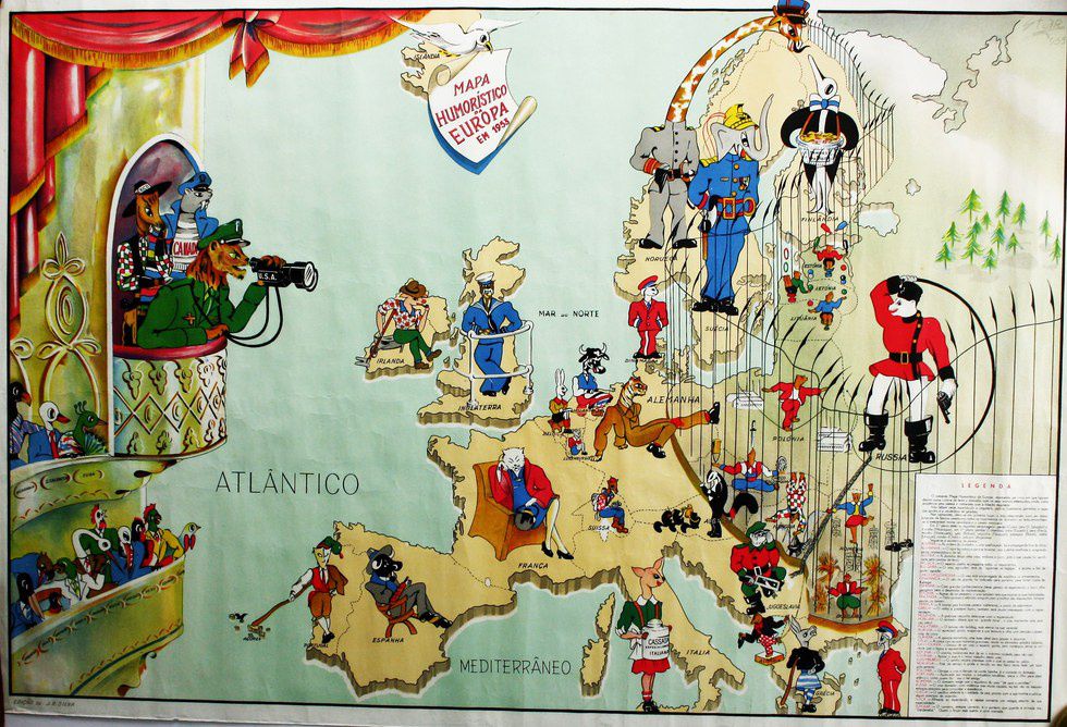
Now for some real world maps. This one is a satirical look at Europe during the Cold War, as seen in a Portuguese magazine. It gives a rather comedic view from a western nation during the time of the Eastern Bloc.
8) Most Common European Surname
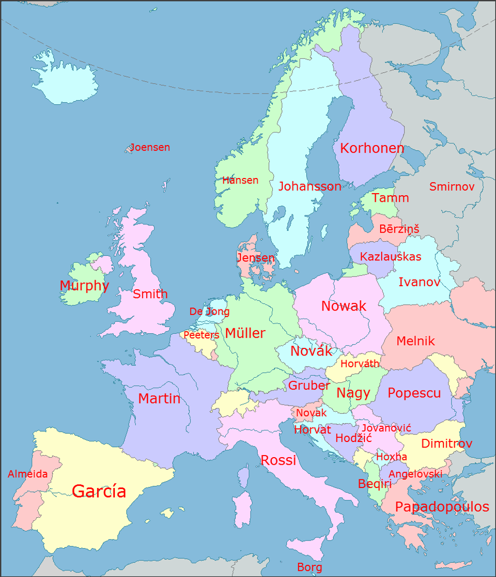
This one is fairly self-explanatory by the title of the map itself. It's a map of the most common surname in each European country. It is interesting to see the trends, most prominently the variants of "Johnson", as seen in the Faroe Islands (Joenson), Sweden (Johansson), Belarus (Ivanov), Denmark (Jensen), and The Netherlands (De Jong); as well as the variants of Novak seen in the Slavic countries in central Europe, including Poland (Nowak), The Czech Republic (Novák), and Slovenia (Novak)
9) Most Common Immigrant Country in Europe
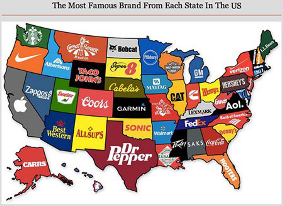
10) Most Famous Brand from Each State
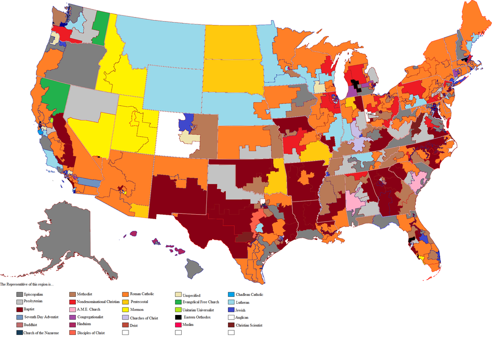
11) Religion of the US Representatives
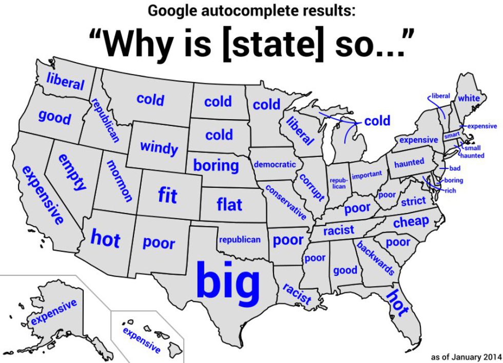
12) Top Google Search Autofill
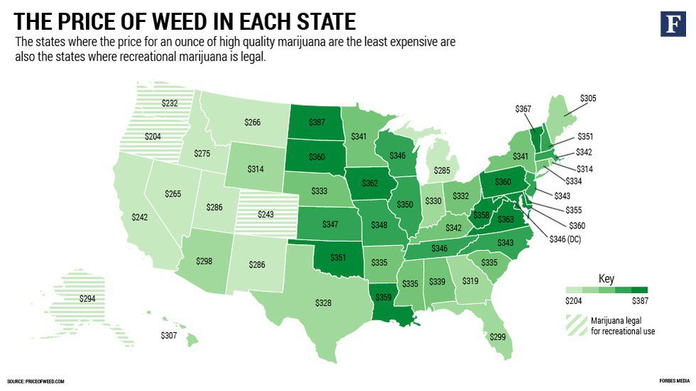
13) Price of Weed by State
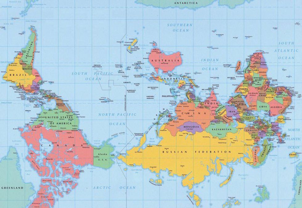
14) Upside Down Map of the World
15) Flag Map of the World
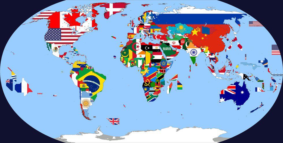
One of my favourite type of maps, this map overlays the flags of every country in the world upon their corresponding territory. Yes, I realise that there are huge chunks of land in the Pacific, those denote the Equatorial borders of islands. It's also interesting to see colour and stylistic patterns by region, especially around Europe and Africa.
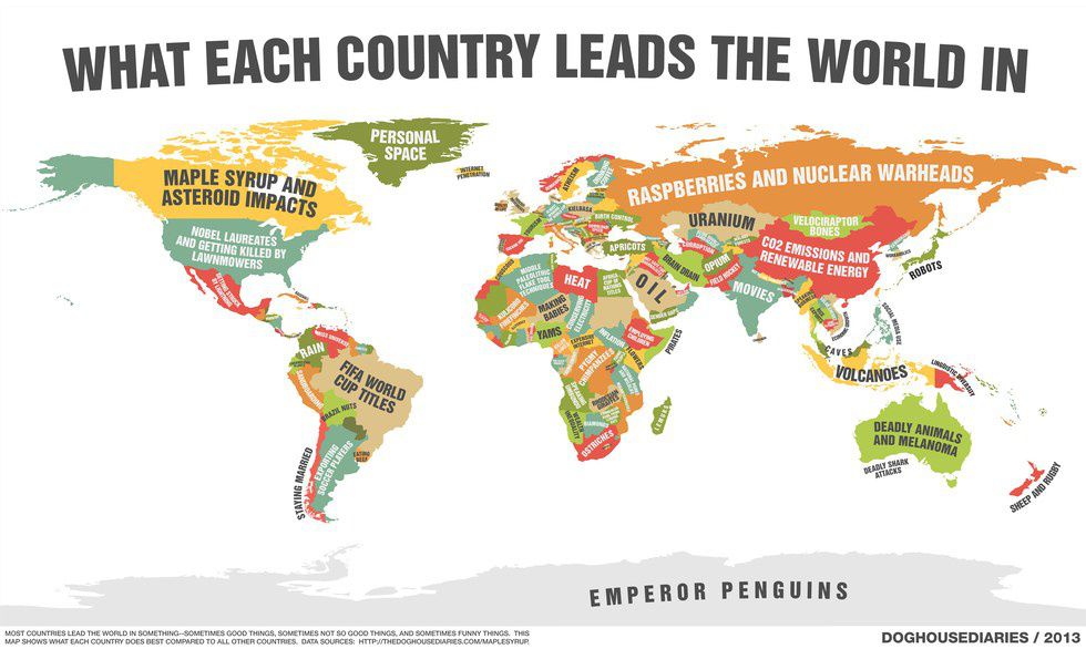
16) Each Country's Leading "Product"
And finally, a semi-comedic map of what each country leads the world in. China has its CO2 emission lead, Canada has its Maple Syrup, Brazil and its World Cup Titles. And Germany, my favourite International Football Club, has its Almost World Cup Titles lead. Savage. Just savage.


