
It's eight o'clock in morning, and I'm my usual morning self: bleary-eyed, discombobulated, and craving bacon. Yet instead of finding myself in a dining hall, eating some of that savory breakfast treat, I am lost in the middle of Somerville, Massachusetts, spinning in circles at an intersection where all the roads look the same. The houses, driveways, trees, cars, and everything in between are all the same to me. For the life of me, I cannot remember where I came from and where I had originally planned to go.
Trust me when I say it was not how I'd planned to spend my Saturday morning (although I suppose I had it coming for me the minute I put on sneakers instead of slippers). Only after a panicked fifteen minutes of taking left, right, and what feels like upside-down turns did I remember the wonderful GPS skills of my iPhone and was able to map my way right on home.
Through far too many attempted runs much like this one, I was able to figure my way around the Somerville/Medford area. Though a suburb of Boston, there are a surprising number of "escape routes" to take you away from the hustling, bustling crowds. Below are some of the best I've found, all varying distances, along with a few other resources to get you up and running.
1. Alewife Greenway Bike Path: 3.4 Miles
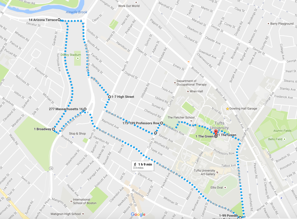
This trail brings you along a wooden bike bridge next to a small stream, and various plants surround the path to truly bring you back to nature.
Link to Google Map route: https://www.google.com/maps/dir/42.40685,-71.11930...
2. Somerville Community Path: 4.1 Miles
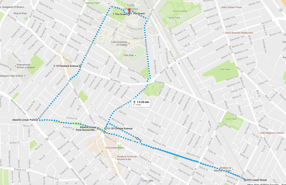
This trail brings you along a community walking path through Davis Square and the varying apartment complexes in the surrounding area. As commercial as that sounds, community members have kept the area clean and allowed the wildlife next to the trail to flourish. There are also art sculptures on the second half of the trail.
Link to Google Map route: https://www.google.com/maps/dir/42.4068537,-71.119...
3. Minuteman trail: 6.3 Miles
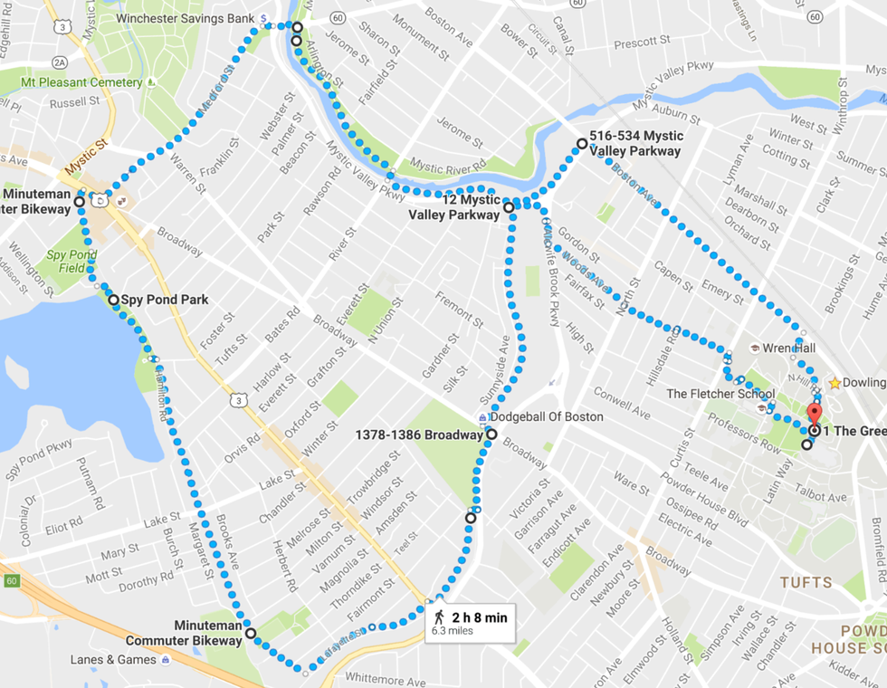
The Minuteman trail is a fantastic commuter pathway that stretches far longer than the route listed here. It brings you through parks and next to bodies of water, and if you follow the turns listed here, you can loop back around to Mystic Lake.
Link to Google Map route: https://www.google.com/maps/dir/42.4065608,-71.119...
4. Mystic River Path: 4.2 Miles
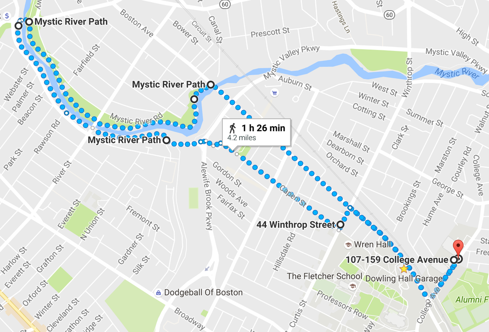
This mileage on this route can be altered because of the various bridges along the Mystic River Path. You can choose to turn around at any point, which allows it to be any distance. The path itself isn't paved, which is also a great plus for the knees.
5. Mystic Lake Loop: 9.7 Miles
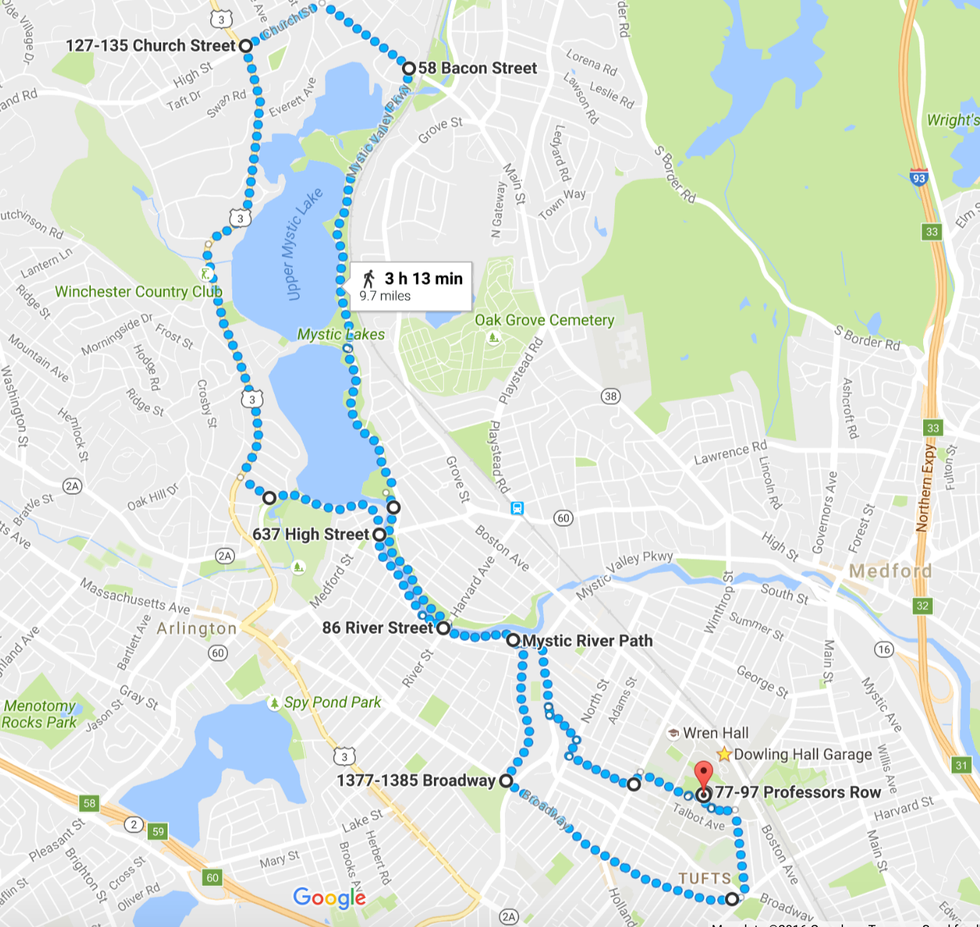
This is an example of how to make the Mystic River Path into a much longer run. The surrounding neighborhoods near the trails on the riverside are usually free of traffic, and it's a beautiful loop even on a rainy day.
Link to Google Map route: https://www.google.com/maps/dir/42.4065755,-71.119...
6. Medford Community Garden & Mystic River Reservation: 6.8 Miles
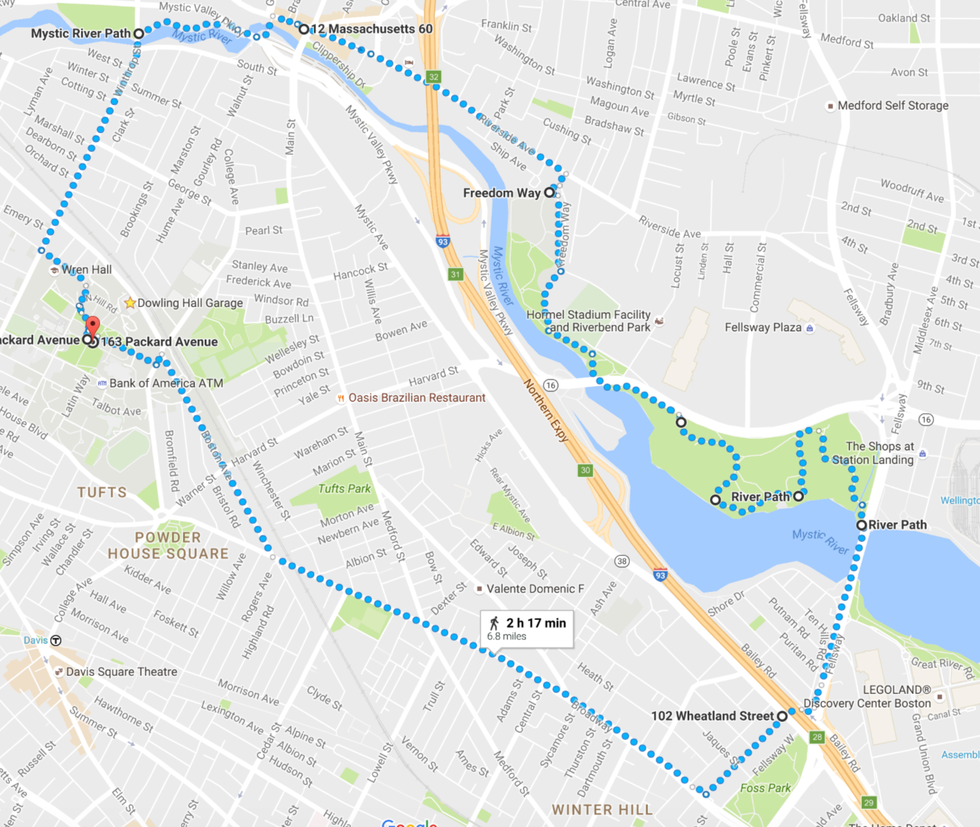
Medford typically isn't where I choose to run, but there are quite a few parks that you can string together to turn into this route. Once you get to the Medford Community Garden there are gravel trails, which gives it a better feel.
Link to Google Map route: https://www.google.com/maps/dir/42.4073162,-71.120...
7. Hahvahd Yahd: 5.9 Miles
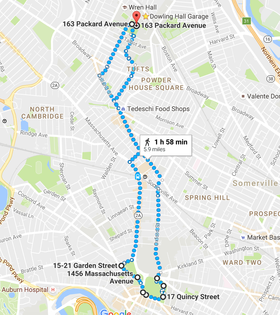
Harvard Yard is always a great destination, as the school gates are always open to the public. Unfortunately getting there from campus efficiently requires running alongside some of the busier roads (even though on sidewalks) which I don't enjoy as much on a run.
Link to Google Map route: https://www.google.com/maps/dir/42.4073162,-71.120...
8. Mt. Auburn & Doctor Paul Dudley White Bike Path: 9.9 Miles
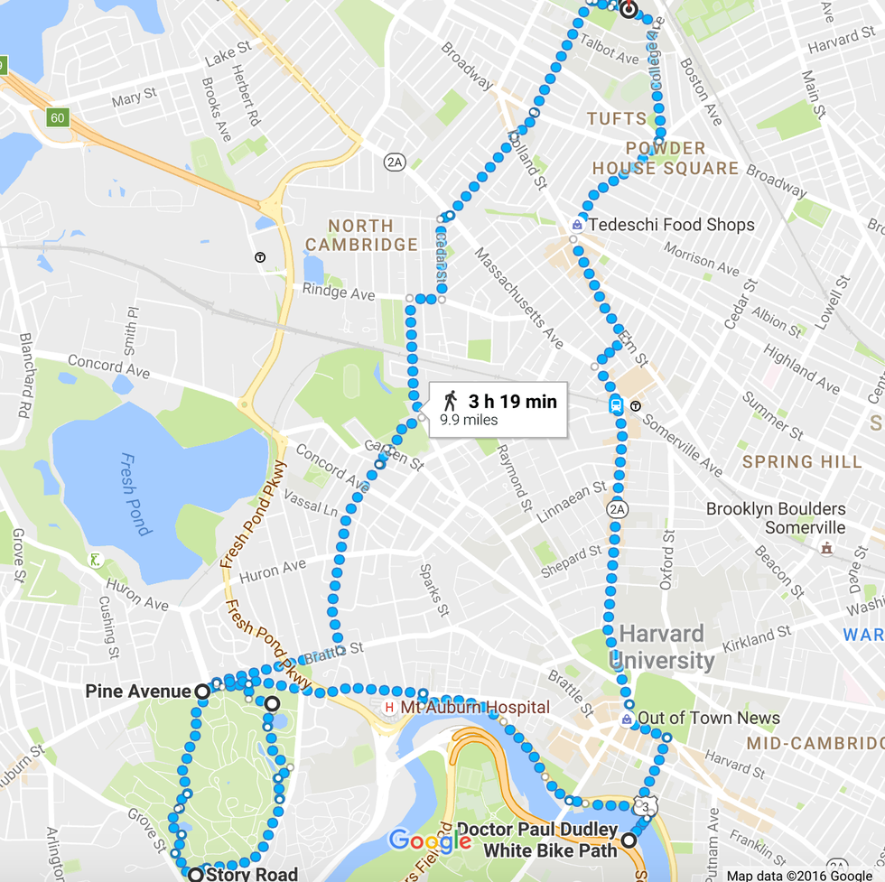
There are some beautiful trails along the Charles River, and this led me to find some of the surrounding parks as well. The bike path that goes across the water adds the perfect finishing touch.
Link to Google Map route: https://www.google.com/maps/dir/42.4073162,-71.120...
9. Boston Common & Charles River Esplanade: 12.4 Miles
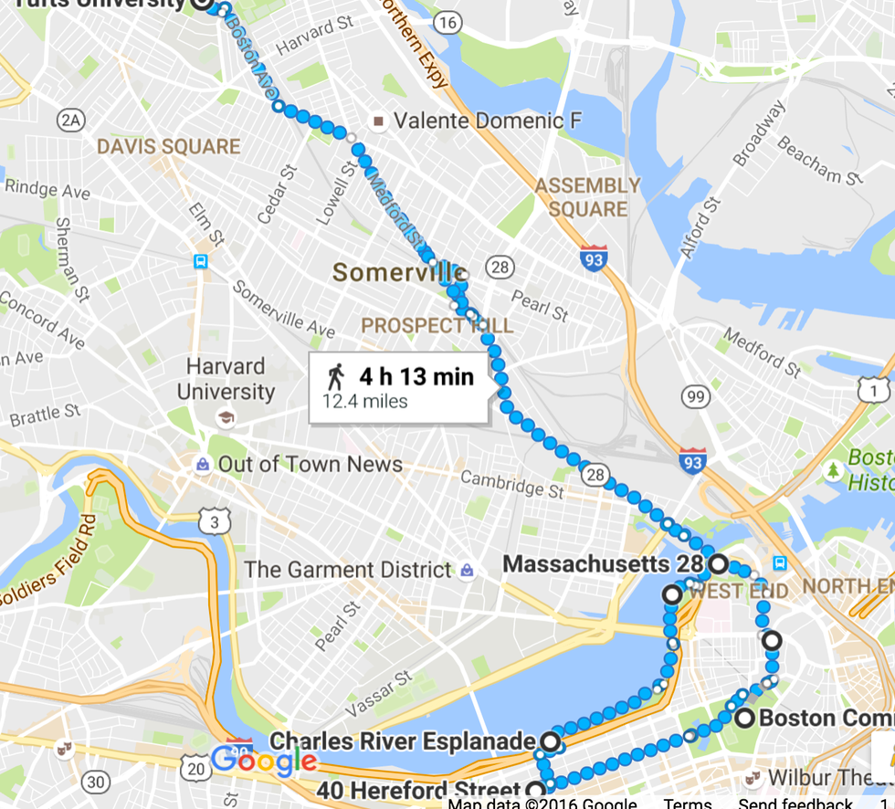
Similar to the Harvard route, this requires running through some of the busier areas. However, once you get to the Boston Common and Charles River areas, it becomes a rewarding long run.
OR take the T and skip the initial, lengthy part: https://www.google.com/maps/dir/Tufts+University,+Boston+Avenue,+Medford,+MA/Boston+Common,+Tremont+Street,+Boston,+MA/@42.3820178,-71.1273172,13z/data=!3m1!4b1!4m14!4m13!1m5!1m1!1s0x89e376dddad80b1f:0xae7335a1f8833ce5!2m2!1d-71.1190232!2d42.4074843!1m5!1m1!1s0x89e3709dbc6e232b:0x3f8683fc7ba94f04!2m2!1d-71.0655822!2d42.3551128!3e3
10. Tufts Track: Various Mileage
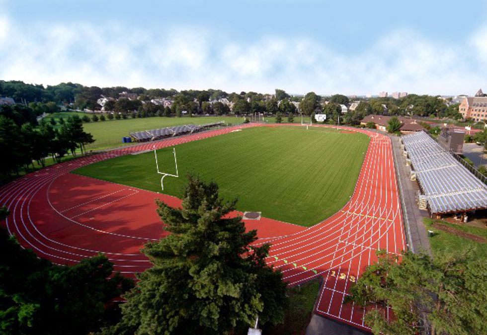
The Ellis Oval is also a great place to run on campus, especially when you need a break from some of the longer runs. It also provides great motivation when there are other people running as well.
Additionally, the app Map My Run helps link routes directly to your smartphone, and there are currently 5,000 posted for the Somerville area. Below is a link to that specific posting, but I would highly recommend downloading the app to discover even more that are fitted to your route preferences.
Link to Map My Run routes: http://www.mapmyrun.com/us/somerville-ma/
Of course, there's always the Tisch Fitness Center as well, with its indoor track, variety of gym equipment, basketball courts, sauna, and Hamilton pool. When the inevitable New England winter comes around, this is the best bet.